At the turn of this century, I was working at a dot-com in Seattle where our business model centered on producing websites for automobile dealers. In those days, that meant scraping inventory out of mainframe-based dealer data systems, and wrapping the inventory up with stock photos and salesperson contact info. It was a 70-hour-a- week gig in the late ’90s, wrangling hardware stretched past its limits with software that—shall we say—wasn’t ready for production: Good times.
The ordeal raised my tech-game and elevated my career path, but the two best things that came out of the job were adventures.
My closest compadre at work was a brilliant man from Mahrashtra, India. Raj and I teamed to manage the swelling local databases and keep them humming during traffic spikes. I recall having a dream wherein we were prison guards, and the keys on my belt were jingling as the inmates grew restless. When I awoke, it was the pager I wore that was buzzing.
By early 2000, however, the worst was past, and Raj figured it was time to get married. Or perhaps his pa and ma had figured it was time; the girl had already been chosen, years before, and all that was left was the wedding. When Raj announced that he’d be returning to India for a month, I teased him, asking, “You’re going to India, and you don’t invite me?”
“You want to come? Sure, you should.”
One should answer the door when opportunity knocks, so I did. During the subsequent weeks of preparation, my old riding buddy Scary Don heard about it, arranged to meet Raj, and received the same invitation that I had. Then Don convinced me we should rent motorcycles and do some two-wheeled touring “of the Subcontinent.” (Our trip to Pune is a story in itself, as is the epic of the wedding ceremonies, but we’re talking about adventure now, so we’ll skip over those.)
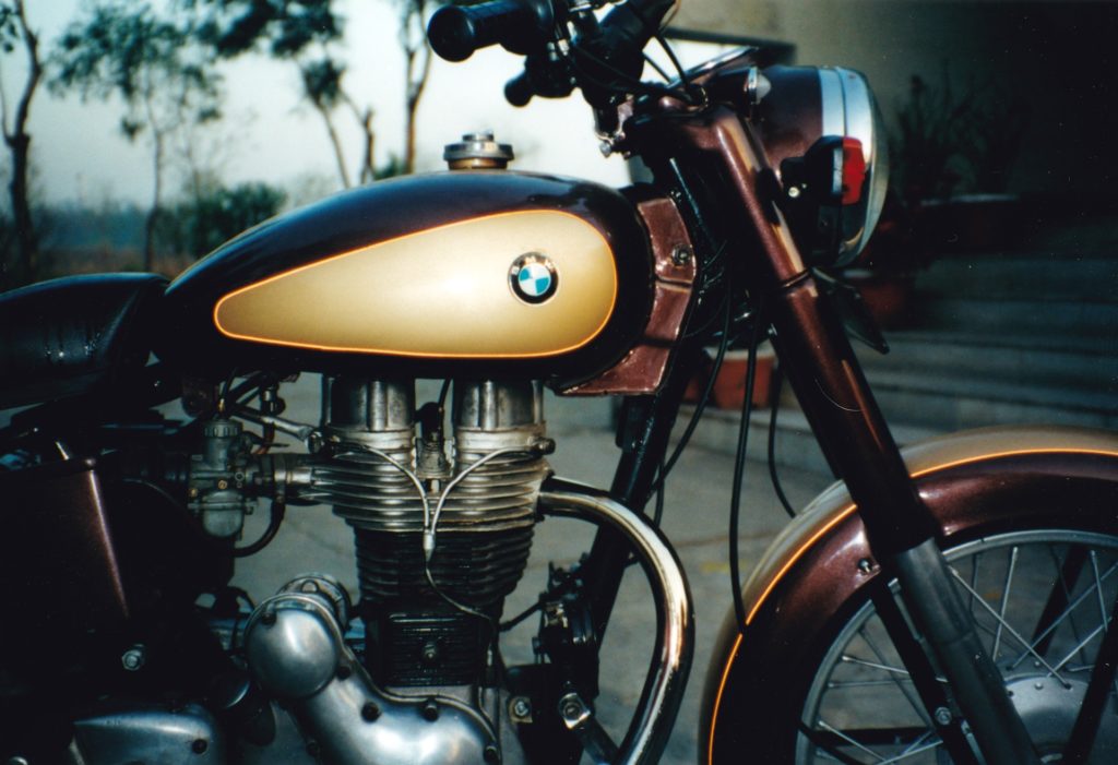
One of the lesser-known early BMWs is actually an Enfield with a roundel emblem.
Jump ahead now to the point when Don and I, on rented Royal Enfields, are heading for Ramnagar at the foot of the Himalayas. Maps of the region were hard to find before we left the U.S., and even in Mumbai, the bookstore operators just give a little sideways shake of their heads when asked about atlases. Our navigational aids are a 1:1,000,000 map, a tiny Garmin GPS, a lot of shouted questions at folks nearby—”Moradabad Road?” (pointing ahead)—and sometimes just following the main flow of traffic through a crowded city. These were the days when only the Americans had a GPS constellation up, and also the days of “selective availability” of the GPS signals (read: intentional errors introduced in order to reduce the accuracy of Terran position-finding). We had the “GPS track” turned on in the Garmin to try to keep a breadcrumb trail, but even coming back along the same road, the GPS showed the track hundreds of yards away. Most of the time we had only a faint idea of where we were.
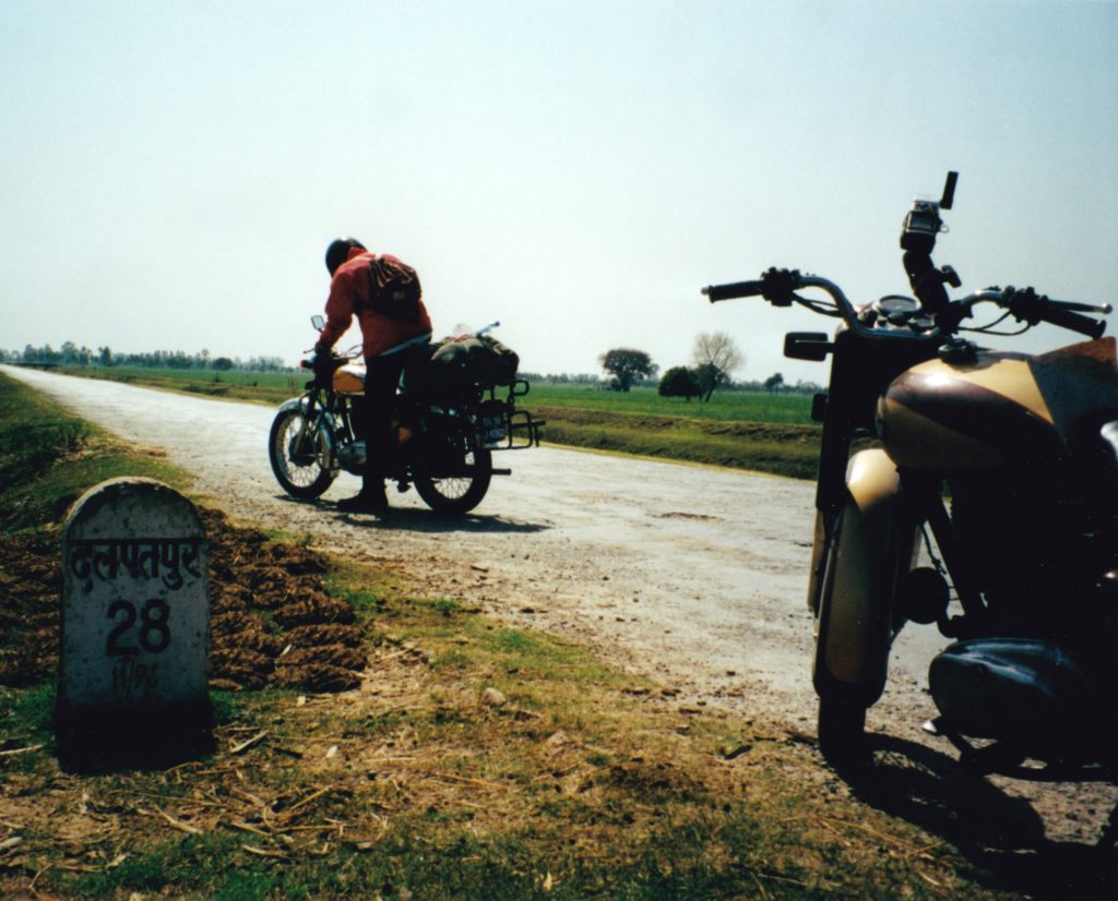
Somewhere on the road to Nagpur, I think.
The U.S. abandoned selective availability in May 2000, and the increased precision begat a new sport: geocaching, a combination of orienteering and treasure-hunting in which players exchange latitude and longitude measurements and puzzle clues to lead each other to out-of-the-way locations across the globe. Once the GPS gets you close, you switch into treasure-finding mode; some of the cache containers are no larger than a filbert.
Geocaching became a hobby for Renée and me early in our relationship, and it’s taken us to many places off the beaten path: Tuktoyuktuk, on the shores of the Beaufort Sea; Mt. Tabor, an extinct volcano in the heart of east Portland, Oregon; the ancient paths in England’s Lake District.
And of course Wyoming.
We were actually headed for a geocache in next-door South Dakota, but the roads in Wyoming’s open space between the Rockies and the Black Hills are a more direct route north. Once we reached the latitude of the cache, we’d turn eastward to cross the state line and claim the prize. So we’re running on a two-lane in eastern Wyoming, Renée driving. Way ahead we see three cars in a pod; it takes us six miles to catch ’em. They’re right at 68 mph, and lined up without any extra space between.
A long open stretch appears. “Take them all?” asks Renée.
I’m like, “Yeah, floor it.”
She’s abreast of the middle car, still with lots of open road ahead, and she’s easing up. “Keep your foot down,” I suggest.
“We’re goin’ a hundred.”
Well, okay then: the diesel X5 was so smooth, I hadn’t noticed our speed.
Cache in the bag, sandwiches in our bellies, we came down through South Dakota and Nebraska in beautiful rolling hills. Made it home by nightfall, an easy 600-mile day. Then, about six weeks later, we noticed something amiss in our geocache logs: Our South Dakota cache had been reclassified as a Wyoming cache. Ack! Musta been too close to the state line! We’d toyed with the idea of picking up another cache on our trip, but nothing in our travel radius looked interesting enough.
Now, to support our quest to geocache in every state, we had to go back to South Dakota.
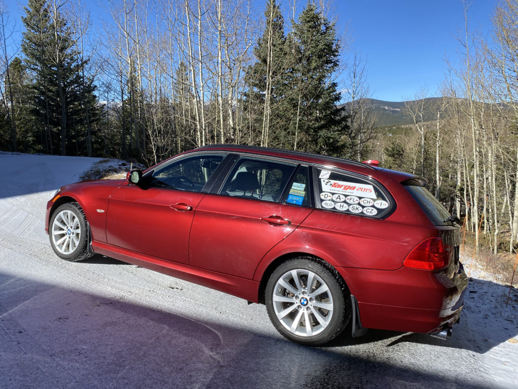
We lined up two desirable targets in the Mt. Rushmore State, and planned an early departure for Saturday. Because we’d have to go farther north than we had previously, we’d make it a two-day trip. But our horse pulled up lame: the X5 burned out one of its HID capsules Friday afternoon, and I didn’t have a spare capsule. I have a (deserved) reputation for loving good lights, and the idea of leaving home with half-candlepower wasn’t gonna fly: Time to switch cars.
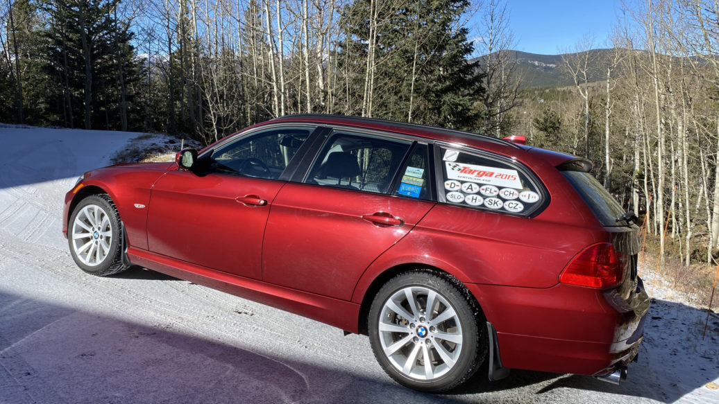
Our 2012 sportwagen‘s been places, and done things.
In the corner of the garage, under a cozy cover and the glow of the battery tender, the red wagon waits. Colorado DOT’s affinity for magnesium chloride (they don’t call it salt) keeps the wagon off the road in the winter; BMW’s not bringing any more six-pot manuals to these shores, so preserving this one is a goal. Pity: It’s much more lively and precise on the road than the SAV, even if its non-turbo N52 engine is short of breath at altitude.
For this mission, however, it’s perfect. And the weather doesn’t look bad for the weekend….
Hmm: Driving in Wyoming the week before Halloween… why does that notion ring a bell with me? Huh, probably nothing. Let’s get going.
Down out of the Front Range, heading north on I-25, we’re through Cheyenne before noon, then up, up, heading toward Douglas and the change from freeway to state highway. An overhead sign warns of winter weather for later that night. Pshaw; we’ll be geocached and safely snug in our hotel before nightfall. Through Douglas, almost no traffic on the two-lane, the sky a bit overcast but the temperature’s all right. A bit further along our north-northeast track and the overcast has met the northern horizon, and taken on a tinge of citrus, yellow-green hues waving slowly along the wall of clouds. Ah! Now I remember—I remember that sky!
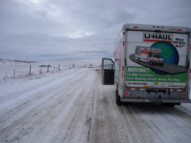
When Buell motorcycles shut down in the fall of 2009, I flew to Wisconsin to visit the factory and pick up a new bike at the nearest dealership. It was the week before Halloween; my intended route crossed Iowa, Nebraska, Wyoming, Idaho, and finally Oregon. At an overnight stop in North Platte, I switched on the TV weather and saw a gigantic blob descending from Canada; it stretched from Osoyoos to Manitoba, and was vectored to roll right down the crest of the Rockies. Motorcycles don’t work well without traction, so next morning I strapped the bike in a U-Haul and four-wheeled west.
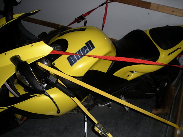
Secured for its own protection, the 1125R becomes cargo.
Crossing the state line, the overcast met the western horizon, and took on a tinge of citrus, yellow-green hues waving slowly along the wall of clouds.
Somewhere on a county road northwest of Fort Collins, the weather lifted enough to take a picture.
When I reached Cheyenne in the evening, all of the roads out of town were closed. I made it to a hotel, and was checking in when the clerk asked, “How many nights?”
“Just one, thanks.”
“Oh, really?” she smiled. There was no clearer way for me to admit that I wasn’t from around those parts. Three days later I managed to leave in the chained-up U-Haul, but it was a daunting trip. I’m surprised that the Wyoming stranding had slipped my mind.
This year we didn’t reach our hotel. Even if we’d beenclose, we couldn’t have seen it through the windblown flakes. Near Gillette we switched to Plan B, the central goal of which was get the hell back south pronto. A course skirting east let us collect our geocache, and steady—not to say stubborn—driving got us to Torrington in the southeast corner of the state. Excellent lights, particularly the more yellow-toned auxiliary units on the nose of the wagon, were a large factor in our progress. Equally important, the E91’s xDrive and good snow tires supported our rapid retreat. In the morning we decamped early, and escaped the second wave of weather before highway closures locked things down.
Detail-oriented types will be wondering what the “second adventure” to come out of my time at the dot-com was (riding with Scary Don in India being the first). Renée is the second adventure: that job was where I met her. And she’s the one who proposed that we cure our South Dakata geocache loss the week before Halloween.—Marinus Damm
[Photos courtesy Marinus Damm, Don Siewert.]